 McCormick and
Baxter Site before remediation
McCormick and
Baxter Site before remediationSite Summary: McCORMICK & BAXTER CREOSOTING CO.
(PORTLAND PLANT)
OREGON EPA ID# ORD009020603 / EPA Region 10
Portland, Multnomah County
Last Update: April, 1999
<CLICK HERE FOR SYNPOTIC LOCATOR MAP>
Site History and General Characteristics:
McCormick and Baxter Creosoting Company, Portland Plant site ("McCormick & Baxter" or "site") is a former wood treatment facility located on the Willamette River in Portland, Oregon. The site is located on the east bank of the Willamette River and covers approximately 43 acres of land and 15 acres in the river.Wood treatment operations were conducted on the site between 1944 and 1991. Wood treating products used at the site include creosote/diesel oil mixtures, pentachlorophenol (PCP)/diesel oil mixtures, and a variety of water- and ammonia-based solutions containing arsenic, chromium, copper, and zinc. Between 1945 and 1969, wastewater and non-contact cooling water were discharged directly into the Willamette River. Prior to 1971, boiler water, stormwater, and oily wastes were disposed of in the western portion of the site. The facility ceased wood treating operations in 1991. Approximately 4,500 people live within one square mile of the site. The city of Portland recently purchased 27 acres immediately north of the site for a greenway.
The site is downstream of Swan Island and upstream of the St. John's Bridge and is located in an area that was constructed using dredged material in the early 1900s. The site, which can be accessed from North Edgewater Street, consists of approximately 43 acres on land and 15 acres in the river. It is generally flat, and lies between a 120-foot-high bluff along the northeastern border and a 20-foot-high bank along the Willamette River to the southwest. A sandy beach is exposed at the base of the bank except during periods of high river stage (generally late winter or early spring). The site is bordered by industrial properties to the south, the Willamette River to the west, Burlington Northern Sante Fe Railroad tracks to the north, and Union Pacific Railroad tracks and a residential area on top of the bluff to the east.
The driveway leading into the McCormick and Baxter property and the parking lot is paved; the remainder of the property is unpaved, covered with gravel, or vegetated. There is an office building, a laboratory, a former shop building (currently used to house the water treatment plant), and several sheds remaining on the property. In addition, several process-related structures remain, including the foundation of demolished buildings, concrete retort sumps, concrete containment walls around the former location of the tank farm and creosote tank, and a creosote dock. A Burlington Northern Railroad spur (approximately 7,500 linear feet) crosses the western portion of the property. The entire perimeter of the McCormick & Baxter property is fenced, and warning signs are posted on the fence.
Contaminated Areas:
Three main contaminant source areas exist at the site: the former waste disposal area, the central process area, and the tank farm area.Other source areas include the southeast disposal trench area, located southeast of the tank farm area, which received overflow of oily wastes from the system pits and tank farm; miscellaneous small waste disposal areas; and monitoring well MW-1 located near the entrance to the property. It has been determined that the contaminants in this well are not the result of wood-treating activities; their source is unknown. No registered historical landmarks or structures with historical significance have been identified at the site.
Geography and Hydrogeology of the Site:
The McCormick & Baxter property is located on a generally flat terrace with surface elevations ranging from about 29 to 36 feet above mean sea level. The site is located at River Mile 7 on the Willamette River. The elevation of the 100-year flood plain along the reach of the Willamette River is 28 feet NGVD (National Geodetic Vertical Datum 1929), and the elevation of the 500-year flood plain is 32 feet NGVD.Three hydrostratigraphic units are present at the site: the shallow, intermediate, and deep aquifer zones, which are interconnected to varying degrees depending on the location within the site. The shallow, unconfined sand fill aquifer is present across the entire site, and ranges in thickness from about 5 to greater than 30 feet. Depth of the groundwater ranges from approximately 20 to 25 feet below ground surface (bgs). The base of the shallow aquifer is defined by a silt aquitard. The intermediate aquifer (ranging from 0-50 feet in thickness) is composed of alluvial sand and occurs below the silt aquitard. The deep aquifer zone is present in all portions of the site and consists of alluvial sands. This aquifer is directly connected with the intermediate and shallow zones along the river margin.
Land and Water Use:
The City of Portland supplies drinking water to residential areas in north Portland, including the site. The only current use of groundwater in the vicinity of the site is by the University of Portland which operates a supply well for irrigation. This supply well is completed in the deep aquifer. The Willamette River is the only surface water body at the site. The Willamette River is not used as a drinking water source downstream of the site. Land use at the site has been industrial since the 1940s and it has been projected to continue as industrial, or perhaps recreational, in the future. There are established railroad right-of-ways on two sides of the site, and it is anticipated that the area on top of the bluff will remain residential. The site is a highly developed industrial area with little terrestrial wildlife habitat; however, numerous benthic (sediment dwelling), aquatic, and amphibian species have been observed at the site.Media Affected:
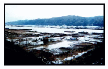
Soil & Sludges, Surface Water Soils at the site are contaminated with wood treating chemicals, including heavy metals, polycyclic aromatic hydrocarbons (PAHs), and PCP reaching depths of 80 feet in some areas. The soil contaminants have migrated to sediments in the Willamette River, resulting in the contamination of the river water. Sediments near the site are contaminated with PAHs to depths of up to 35 feet below the sediment surface. Touching or ingesting contaminated soils, sediments, or surface water could pose a health threat. A variety of recreational activities occur in and along the Willamette River, downstream of the site.McCormick and
Baxter Site before remediation
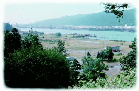 McCormick and
Baxter Site after remediation
McCormick and
Baxter Site after remediation
The site is a state-lead cleanup and is being funded under a Cooperative Agreement between the Oregon Department of Environmental Quality (ODEQ) and EPA.
Early Actions
: ODEQ conducted early actions at the site in 1994. These actions included excavation and off-site disposal of site structures, including retorts and buildings; disposal of wood-treating process waste; treatment of stormwater collected from retort sumps; installation of non-aqueous phase liquid (NAPL) extraction wells; recovery of NAPL and treatment of NAPL-contaminated groundwater.Long-Term Actions
: The final site remedy, selected in April, 1996, includes enhancements to the NAPL extraction/treatment system, on-site soil treatment and/or a soil cap over the entire site, and a sediment cap. A Record of Decision (ROD) Amendment was issued in March 1998 to change the soil remedy to excavation and off-site disposal and treatment. This change was necessitated by the detection of dioxins in the soil, which are not amenable to biological treatment. The soil cleanup started in February 1999. Phase I, consisting of soil excavation and off-site disposal, will be completed by May 1999. A two-foot soil cap is planned for placement over the entire site in 2001. The final groundwater remedy is currently being designed.Site Responsibility:
This site is being addressed through State and Federal actions.
NPL Listing History
DatesProposed Date: 06/23/93
Final Date: 05/31/94
Deleted Date: n/a