 McCormick and
Baxter Site before remediation
McCormick and
Baxter Site before remediationSuperfund Sites in the Portland Harbor Area: Gould and McCormick & Baxter
Record of Decision (ROD)
>> PLEASE ALSO READ THE SUMMARY LINKED HERE (click)
<CLICK HERE FOR SITE LOCATOR MAP>
<CLICK HERE FOR SYNOPTIC LOCATOR MAP>
Site Name: GOULD, INC
Address: 5909 NW 61ST AV, PORTLAND, OR 97208
EPA Region: 10
County: 051 MULTNOMAH
Congressional District: OR 3rd
Metro Statistical Area: 6440
NPL Status: Currently on the Final NPL
Federal Facility Flag: Not a Federal Facility
Federal Facility Docket: No
Ownership Indicator: Other
Incident Category: Manufacturing Plant
RCRA Facility ID:
FMS SS ID: 1023
USGS Hydro Unit: 17090012
|
ROD ID |
ROD Date |
OU (Operable Unit) |
|
1 EPA/ROD/R10-88/013 |
03/31/1988 |
01 |
|
2 EPA/541/R-97/060 |
06/03/1997 |
01 |
1) Record of Decision (ROD):
Operable Unit: 01
ROD ID: EPA/ROD/R10-88/013
ROD Date: 03/31/1988
Media: SEDIMENTS SOIL
Contaminant: LEAD
Keys: AIR MONITORING, ACIDS, CAPPING, CLEAN AIR ACT, DIRECT CONTACT, EXCAVATION, GROUND WATER MONITORING, INTERIM REMEDY, LEAD, METALS, O&M, OFFSITE DISPOSAL, ONSITE DISPOSAL, ONSITE TREATMENT, RCRA, SEDIMENTS, SOIL, STABILIZATION, SURFACE WATER MONITORING, TREATMENT TECHNOLOGY
Abstract
:The Gould site is located in a heavily industrial area of Portland, Oregon, approximately 1.3 miles southeast of St. John's bridge. The site is contained in a 60-acre study area consisting of the Gould property and outlying areas containing battery casings and other residues from site operations. The area is sparsely populated and lies on the left bank floodplain of the Willamette river. Doane Lake, a small pond, is located adjacent to the site. The Gould site is mostly paved with asphalt, therefore, onsite flora and fauna are limited. Between 1949 and 1981, various owners operated the site as a secondary lead smelting facility specializing in lead-acid battery recycling, lead-smelting and refining, zinc alloying and casting, cable sweating, and lead oxide production. Operations ceased in August 1981; and by the summer of 1982 most of the structures, facilities, and equipment were removed.
Remediation investigation and production records estimate that 86,900 tons of battery casings, 11,800 tons of matte, and 6,570,000 gallons of acid were disposed of at the site. Approximately 2% of the total volume of battery casings is located in surface piles, the remaining 98% is used as fill material, and is in direct contact with ground water. The primary contaminants of concern affecting the soil and sediments are lead and lead oxide. VOCs were discovered in ground water, but will be addressed in a future operable unit.
The selected remedial action for the soils unit at the site include: excavation of all battery casing fragments and matte from the Gould property and adjacent contaminated areas; a phased design program to determine the amount of material that can be recycled, and to minimize the amount of material that must be RCRA landfilled; separation of battery casing fragments; recycling of all applicable components; offsite disposal of nonrecyclable material failing the EP toxicity test; onsite disposal of nonhazardous, nonrecyclable components; excavation, fixation/stabilization, and onsite disposal of remaining contaminated soil, sediments, and matte with soil capping and revegetation; isolation of surface water runoff to east Doane Lake by site regrading; and a monitoring program to determine changes in ground water contamination over time and to ensure that remediation does not adversely impact air quality.
Additional ground and surface water studies will be performed to determine the need for remediation of the media. The estimated capital cost of this remedy is $3,491,603, assuming a "worst case" scenario where little of the material is recyclable, with present worth O&M of $17,073,581.
Remedy
:This record of decision addresses the soils unit at the Gould site. By doing so the remedy focuses on removing the principal source of lead contamination to the environment. The remedy also includes further study to determine whether additional remedial measures are required for groundwater and surface water at the site. This remedial action is designed to;
The extent to which lead and other components of the battery casings can be recycled will depend on the results of design work under this remedy. The results of the design studies will be used to determine the recyclability of the battery casings and the protective measures to be employed during remediation. A phased approach, described in the selected remedy, will be employed in the design work. It is EPA's intent in selecting this remedy to treat all of the battery casings at the site and at the same time minimize the amount of material that must be sent to a RCRA landfill. Should the results of the design phase show that these goals are not compatible, an additional public comment period will be established and this record of decision may be modified. At such time, EPA would present for comment additional options for dealing with the treated materials.
Treatment and removal of casings and treatment of soils will remove lead and eliminate potential for exposure due to direct contact and ingestion. Immobilization of lead in soils, sediment and matte will reduce migration of lead as a potential source of further contamination to groundwater and surface water at the site. Institutional controls will be implemented, during and after remediation. The purpose of these controls will be to assure that the remedial action will protect public health and the environment during its execution, and to ensure a similar level of protection after the remedial actions have been implemented and prior to a final decision at this site.
2) Record of Decision (ROD):
Operable Unit: 01
ROD ID: EPA/541/R-97/060
ROD Date: 06/03/1997
Media: SEDIMENTS SOIL
Contaminant: LEAD
Keys: Soil, lead, smelting, battery recycling, refining, zinc alloying, casting, lead oxide production, casings, waste materials, disposed, amendment, technical concerns, treated, untreated, contaminated material, consolidated, contained, on-site.
Abstract
:The Gould site is located in northwest Portland, Oregon near the Doane Lake industrial area. It includes property owned by Gould Electronics (just over 9 acres) and portions of property owned by Rhone-Poulenc AG Company, Schnitzer Investment Corporation, ESCO Corporation, and Burlington Northern Railroad Company. A secondary lead smelting facility was constructed on the current Gould property and began operations in 1949 under the ownership of Morris P. Kirk and Sons. Facility operations consisted of lead-acid battery recycling, lead smelting and refining, zinc alloying and casting, cable sweating, and lead oxide production. Discarded battery casings and other waste materials from the operations were disposed of on the Gould property and adjacent properties. NL Industries purchased the property in 1971 and sold it to Gould in 1979. The facility was closed in 1981 and by the summer of 1982 most of the structures, facilities, and equipment had been removed. The Gould site was listed on the National Priorities List (NPL) in 1983 because of documented lead contamination. The original remedy for the site was signed in early 1988. The remedy has been partially completed but the need for this amendment arose as a result of technical concerns. It has been determined that the original remedy is no longer appropriate for completing the cleanup at the site.
Remedy:
The amended remedy allows treated and untreated contaminated material to be consolidated and contained in an on-site containment facility on the Gould property.
Site Summary: McCORMICK & BAXTER CREOSOTING CO.
(PORTLAND PLANT)
OREGON EPA ID# ORD009020603 / EPA Region 10
Portland, Multnomah County
Last Update: April, 1999
<CLICK HERE FOR SYNPOTIC LOCATOR MAP>
Site History and General Characteristics:
McCormick and Baxter Creosoting Company, Portland Plant site ("McCormick & Baxter" or "site") is a former wood treatment facility located on the Willamette River in Portland, Oregon. The site is located on the east bank of the Willamette River and covers approximately 43 acres of land and 15 acres in the river.Wood treatment operations were conducted on the site between 1944 and 1991. Wood treating products used at the site include creosote/diesel oil mixtures, pentachlorophenol (PCP)/diesel oil mixtures, and a variety of water- and ammonia-based solutions containing arsenic, chromium, copper, and zinc. Between 1945 and 1969, wastewater and non-contact cooling water were discharged directly into the Willamette River. Prior to 1971, boiler water, stormwater, and oily wastes were disposed of in the western portion of the site. The facility ceased wood treating operations in 1991. Approximately 4,500 people live within one square mile of the site. The city of Portland recently purchased 27 acres immediately north of the site for a greenway.
The site is downstream of Swan Island and upstream of the St. John's Bridge and is located in an area that was constructed using dredged material in the early 1900s. The site, which can be accessed from North Edgewater Street, consists of approximately 43 acres on land and 15 acres in the river. It is generally flat, and lies between a 120-foot-high bluff along the northeastern border and a 20-foot-high bank along the Willamette River to the southwest. A sandy beach is exposed at the base of the bank except during periods of high river stage (generally late winter or early spring). The site is bordered by industrial properties to the south, the Willamette River to the west, Burlington Northern Sante Fe Railroad tracks to the north, and Union Pacific Railroad tracks and a residential area on top of the bluff to the east.
The driveway leading into the McCormick and Baxter property and the parking lot is paved; the remainder of the property is unpaved, covered with gravel, or vegetated. There is an office building, a laboratory, a former shop building (currently used to house the water treatment plant), and several sheds remaining on the property. In addition, several process-related structures remain, including the foundation of demolished buildings, concrete retort sumps, concrete containment walls around the former location of the tank farm and creosote tank, and a creosote dock. A Burlington Northern Railroad spur (approximately 7,500 linear feet) crosses the western portion of the property. The entire perimeter of the McCormick & Baxter property is fenced, and warning signs are posted on the fence.
Contaminated Areas:
Three main contaminant source areas exist at the site: the former waste disposal area, the central process area, and the tank farm area.Other source areas include the southeast disposal trench area, located southeast of the tank farm area, which received overflow of oily wastes from the system pits and tank farm; miscellaneous small waste disposal areas; and monitoring well MW-1 located near the entrance to the property. It has been determined that the contaminants in this well are not the result of wood-treating activities; their source is unknown. No registered historical landmarks or structures with historical significance have been identified at the site.
Geography and Hydrogeology of the Site:
The McCormick & Baxter property is located on a generally flat terrace with surface elevations ranging from about 29 to 36 feet above mean sea level. The site is located at River Mile 7 on the Willamette River. The elevation of the 100-year flood plain along the reach of the Willamette River is 28 feet NGVD (National Geodetic Vertical Datum 1929), and the elevation of the 500-year flood plain is 32 feet NGVD.Three hydrostratigraphic units are present at the site: the shallow, intermediate, and deep aquifer zones, which are interconnected to varying degrees depending on the location within the site. The shallow, unconfined sand fill aquifer is present across the entire site, and ranges in thickness from about 5 to greater than 30 feet. Depth of the groundwater ranges from approximately 20 to 25 feet below ground surface (bgs). The base of the shallow aquifer is defined by a silt aquitard. The intermediate aquifer (ranging from 0-50 feet in thickness) is composed of alluvial sand and occurs below the silt aquitard. The deep aquifer zone is present in all portions of the site and consists of alluvial sands. This aquifer is directly connected with the intermediate and shallow zones along the river margin.
Land and Water Use:
The City of Portland supplies drinking water to residential areas in north Portland, including the site. The only current use of groundwater in the vicinity of the site is by the University of Portland which operates a supply well for irrigation. This supply well is completed in the deep aquifer. The Willamette River is the only surface water body at the site. The Willamette River is not used as a drinking water source downstream of the site. Land use at the site has been industrial since the 1940s and it has been projected to continue as industrial, or perhaps recreational, in the future. There are established railroad right-of-ways on two sides of the site, and it is anticipated that the area on top of the bluff will remain residential. The site is a highly developed industrial area with little terrestrial wildlife habitat; however, numerous benthic (sediment dwelling), aquatic, and amphibian species have been observed at the site.Media Affected:
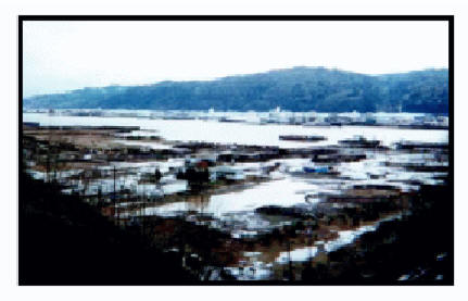
Soil & Sludges, Surface Water Soils at the site are contaminated with wood treating chemicals, including heavy metals, polycyclic aromatic hydrocarbons (PAHs), and PCP reaching depths of 80 feet in some areas. The soil contaminants have migrated to sediments in the Willamette River, resulting in the contamination of the river water. Sediments near the site are contaminated with PAHs to depths of up to 35 feet below the sediment surface. Touching or ingesting contaminated soils, sediments, or surface water could pose a health threat. A variety of recreational activities occur in and along the Willamette River, downstream of the site.McCormick and
Baxter Site before remediation
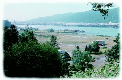 McCormick and
Baxter Site after remediation
McCormick and
Baxter Site after remediation
The site is a state-lead cleanup and is being funded under a Cooperative Agreement between the Oregon Department of Environmental Quality (ODEQ) and EPA.
Early Actions
: ODEQ conducted early actions at the site in 1994. These actions included excavation and off-site disposal of site structures, including retorts and buildings; disposal of wood-treating process waste; treatment of stormwater collected from retort sumps; installation of non-aqueous phase liquid (NAPL) extraction wells; recovery of NAPL and treatment of NAPL-contaminated groundwater.Long-Term Actions
: The final site remedy, selected in April, 1996, includes enhancements to the NAPL extraction/treatment system, on-site soil treatment and/or a soil cap over the entire site, and a sediment cap. A Record of Decision (ROD) Amendment was issued in March 1998 to change the soil remedy to excavation and off-site disposal and treatment. This change was necessitated by the detection of dioxins in the soil, which are not amenable to biological treatment. The soil cleanup started in February 1999. Phase I, consisting of soil excavation and off-site disposal, will be completed by May 1999. A two-foot soil cap is planned for placement over the entire site in 2001. The final groundwater remedy is currently being designed.Site Responsibility:
This site is being addressed through State and Federal actions.
NPL Listing History
DatesProposed Date: 06/23/93
Final Date: 05/31/94
Deleted Date: n/a